Informations techniques
-
Distance 9.6km
-
Type d'itinéraire BOUCLE
-
Dénivelé positif 630m
-
Dénivelé négatif 630m
-
Durée journalière 04h30
- Itinéraire balisé : BALISE
- Nature du terrain : Rock
- Nature du terrain : Ground
- Nature du terrain : Not suitable for strollers
- Altitude max. : 1505 m
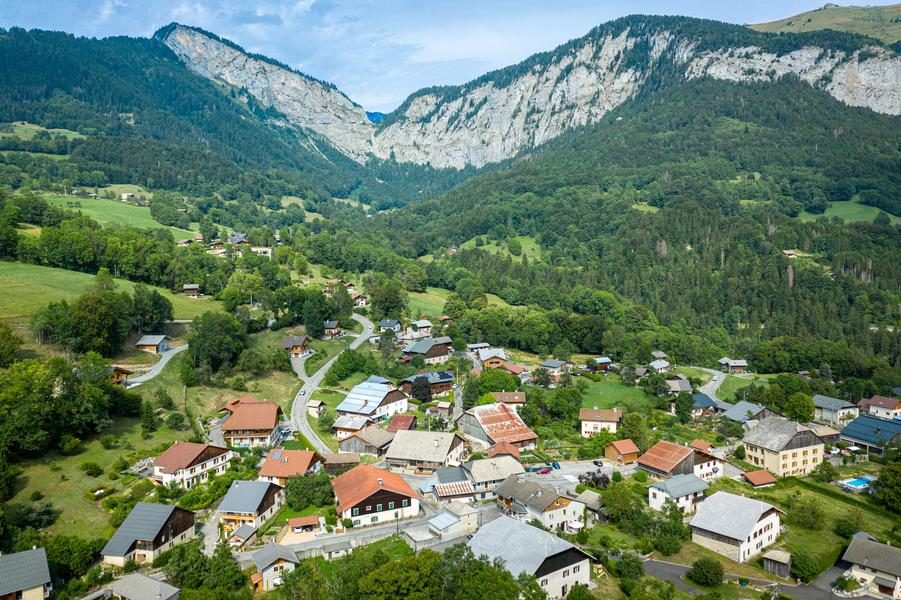
This trail departs from the village of Mieussy and leads to Jourdy cave, along a rocky ridge to Roche Pallud pastures and then back down via a spectacular spur overlooking Saix waterfall.
Animaux
Animaux acceptés : Oui
Animaux acceptés avec supplément : Non
Équipements
- Car park
Multimédia
Services
- Pets welcome
Environnements
- Mountain view
- Mountain location
- Village centre
Tarifs
Free access.
Période d'ouverture
From 15/05 to 15/11.
Subject to favorable snow and weather conditions.
Ouverture complémentaire
- Subject to favorable weather
- Subject to snow conditions
Tourisme adapté
- Not accessible in a wheelchair
Type de clientèle
- Walkers/hikers
- Level red – hard
Thèmes
-
Guidebook with maps/step-by-step : From Jourdy car park, the path leads up to Jourdy cave, then a narrow path along the top of the cliff, with a handrail, to Roche Pallud. The itinerary crossed over Sommand plateau and then veers to the left at the residences, towards Mieussy. The path goes past the top of a waterfall along a walkway, crosses a cliff along a narrow spur with a handrail, and then leads back down along a scree path to Clos d’en Bas. You will then walk along some very pleasant country paths, until you reach Jourdy car park.
To see along this trail:
- The Way of the Cross
- Jourdy Cave, used as a hiding place by the vicars of Mieussy during the period of the terror from 1792 to 1796.
- Sommand pastures and plateau
- View over the Mont-Blanc mountains.
Pour plus d'informations sur le traitement des données personnelles, cliquez ici.
- This field is for validation purposes and should be left unchanged.


