Lac de Roy

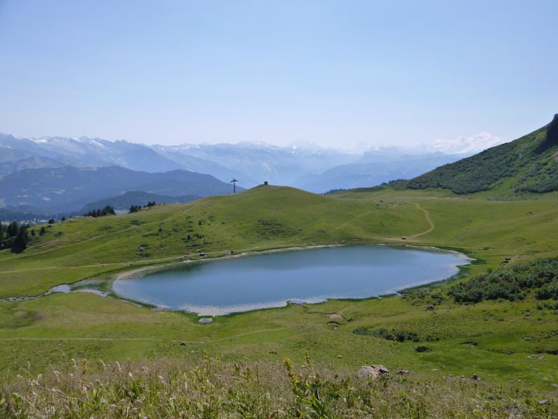
Beginner or family trail to discover Lac de Roy. You'll cross the Véran mountain pasture before quickly reaching Lac de Roy, the glacial lake that is the jewel of Praz de Lys Sommand, with a magnificent panorama of the Grandes Alpes.
Equipments
-
Car park
-
Trail route
Complément accueil
Adapt your equipment according to your level and the weather. Stay on the marked trails.
Environments
-
Mountain location
Rates
Free access.
Itinerary
Opening period
From 15/05 to 15/11.
Subject to favorable snow and weather conditions.
Additional opening
-
Subject to favorable weather
-
Subject to snow conditions
Language spoken
-
French
Location
From Sommand take the route de la Ramaz towards Praz de Lys, arriving at the Col de la Ramaz at 1619 metres, walk towards the lake. From Praz de Lys take the Ramaz road in the direction of Sommand, arriving at the Col de la Ramaz in the direction of Lac de Roy.
Documents
Thèmes
-
Guidebook with maps/step-by-step : From the parking lot, take the wide path towards Lac de Roy. Continue for 900m.
1/ At Chalet de Véran, continue in the same direction for 800m, on the main path.
2/ As you approach Lac de Roy, the path becomes narrower. Follow the left-hand path, fording a small stream flowing from the lake to skirt around it to the left (east bank).
3/ Immediately after crossing the stream, climb a small path to the left, rising to the heights of the lake. After 400m, you come to a chairlift terminal.
4/ Walk past the 2 alpine chalets and take the path on the right that descends towards Lac de Roy.
5/ 100 m after the Chalets de Roy, take the left-hand path to the mountain pasture. Option to shorten the route by taking the western shore of the lake, with a slight ascent.
6/ A must at this stage, a short 200 m detour to the pass (go up on the left) offers a superb view of the other side of the mountain, the Vallée du Giffre, Le Môle and the Aravis massif.
7/ Descend these 200m and follow the path on the left towards the lake.
8/ From the stream crossing, return to the Col de la Ramaz parking lot by the same route.


