



Trail Route: Lac de Roy
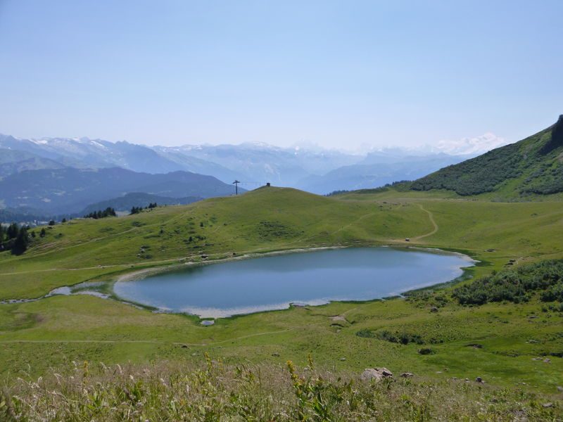


A beginner- or family-friendly trail that lets you explore Lac de Roy. You’ll cross the Véran mountain pasture before quickly reaching Lac de Roy, a glacial lake that is the jewel of Praz de Lys Sommand, offering a magnificent panoramic view of the Grandes Alpes.
Equipments
-
 Car park
-
Trail route
More information
Choose gear that's appropriate for your skill level and the weather. Stay on the marked trails.
Environments
-
 Mountain location
Rates
Free access.
Itinerary
Opening period
From 15/05 to 15/11 daily.
Subject to favorable snow and weather conditions.
Additional opening
-
Subject to favorable weather
-
Subject to snow conditions
Language spoken
-
 French
Location
From Sommand, take the Ramaz Road toward Praz de Lys; upon reaching the Ramaz Pass at 1,619 meters, continue on foot toward the lake. From Praz de Lys, take the Ramaz Road toward Sommand; upon reaching the Ramaz Pass, head toward Lac de Roy.
Documents

Themes
-
Guidebook with maps/step-by-step : From the parking lot, take the wide trail toward Lac de Roy. Continue for 900 meters.
1/ At the Chalet de Véran, continue in the same direction for 800 meters along the main trail.
2/ As you approach Lac de Roy, the path narrows. Follow the trail on the left, fording a small stream flowing from the lake to go around it on the left (east shore).
3/ Immediately after crossing the stream, take a small trail on the left that climbs up toward the lake’s higher elevations. After 400 meters, you’ll pass near the top station of a chairlift.
4/ Walk past the two alpine chalets and take the trail on the right that descends toward Lac de Roy.
5/ 100 m past the Chalets de Roy, continue along the path on the left through the alpine pasture. An alternative route along the lake’s western shore is available to shorten the hike, with minimal elevation gain.
6/ A must-see at this point in the route: a short 200-meter detour to the pass (head up to the left) offers a superb view of the other side of the mountain, the Giffre Valley, Le Môle, and the Aravis Massif.
7/ Descend these 200 meters and follow the trail to the left toward the lake.
8/ After crossing the stream, return to the Col de la Ramaz parking lot via the same route.
-
Distance 6.9km
-
-
-


- This field is for validation purposes and should be left unchanged.
Pour plus d'informations sur le traitement des données personnelles, cliquez ici.